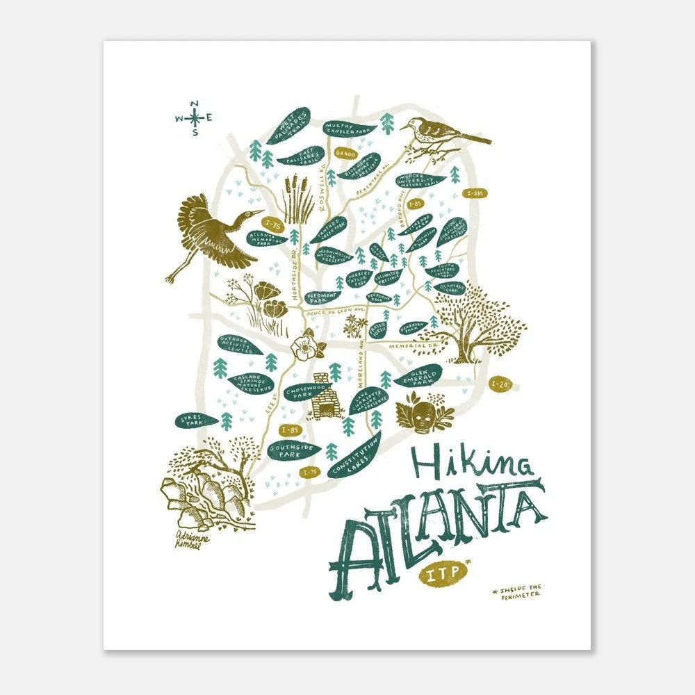
 Image 1 of 4
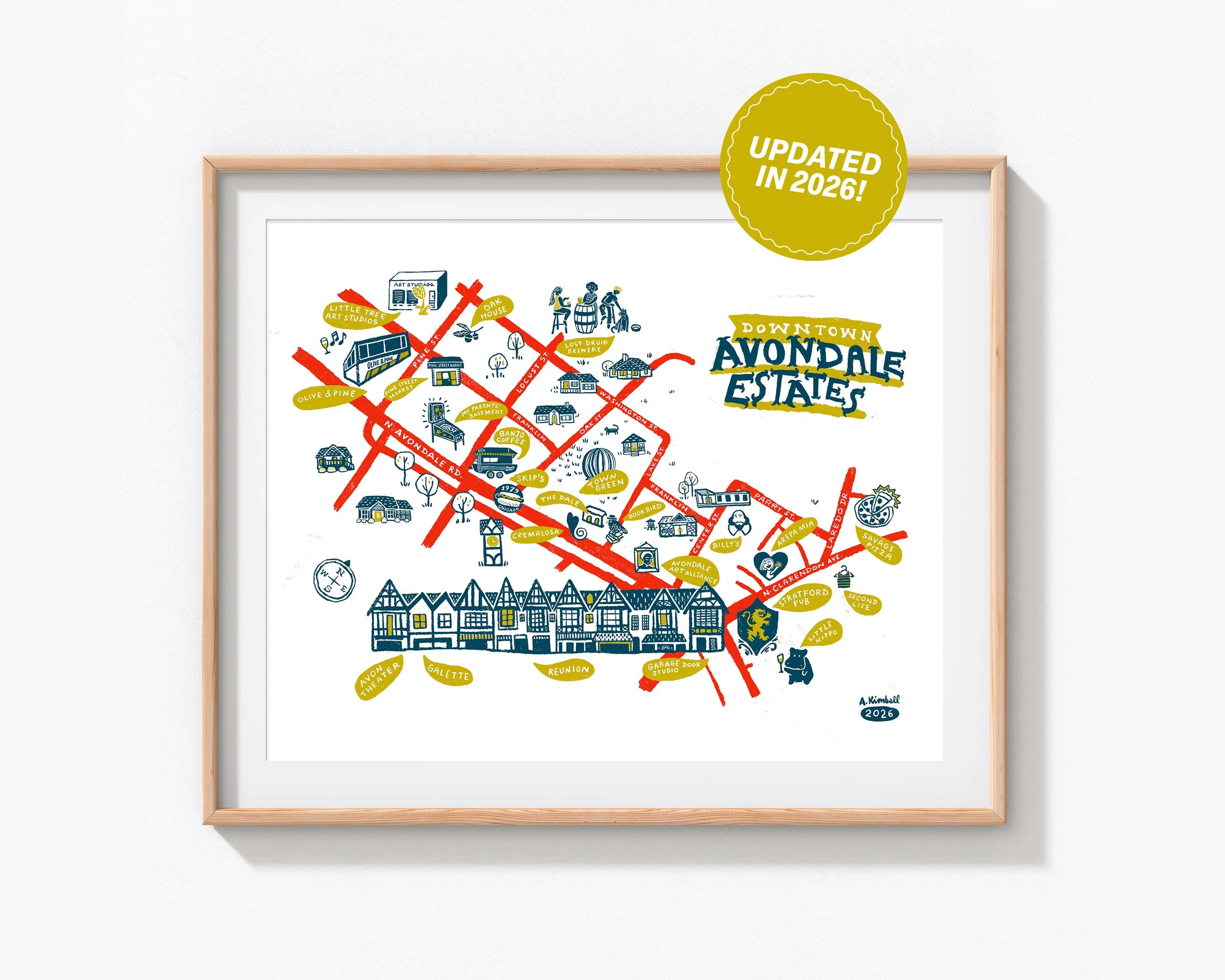
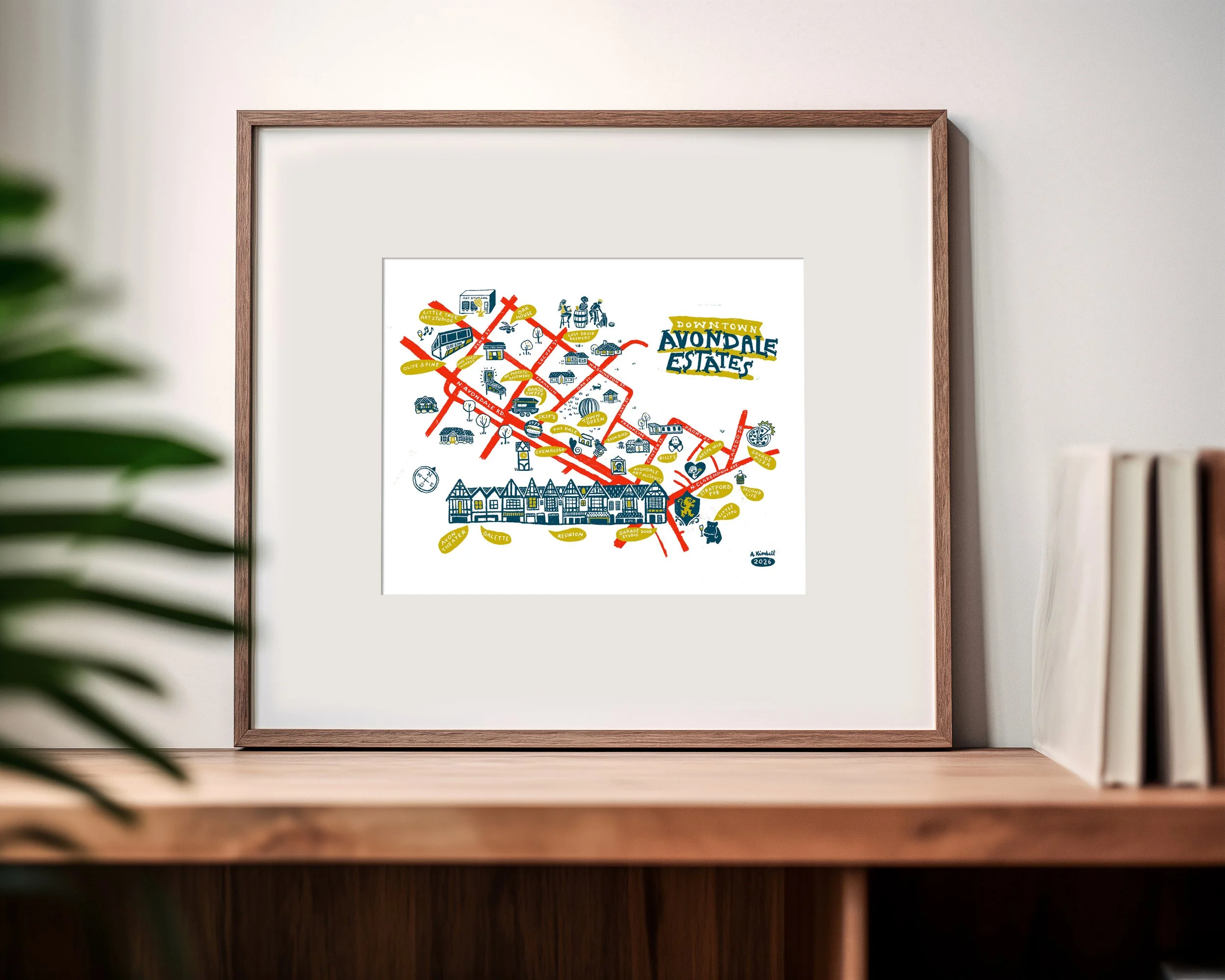 Image 2 of 4
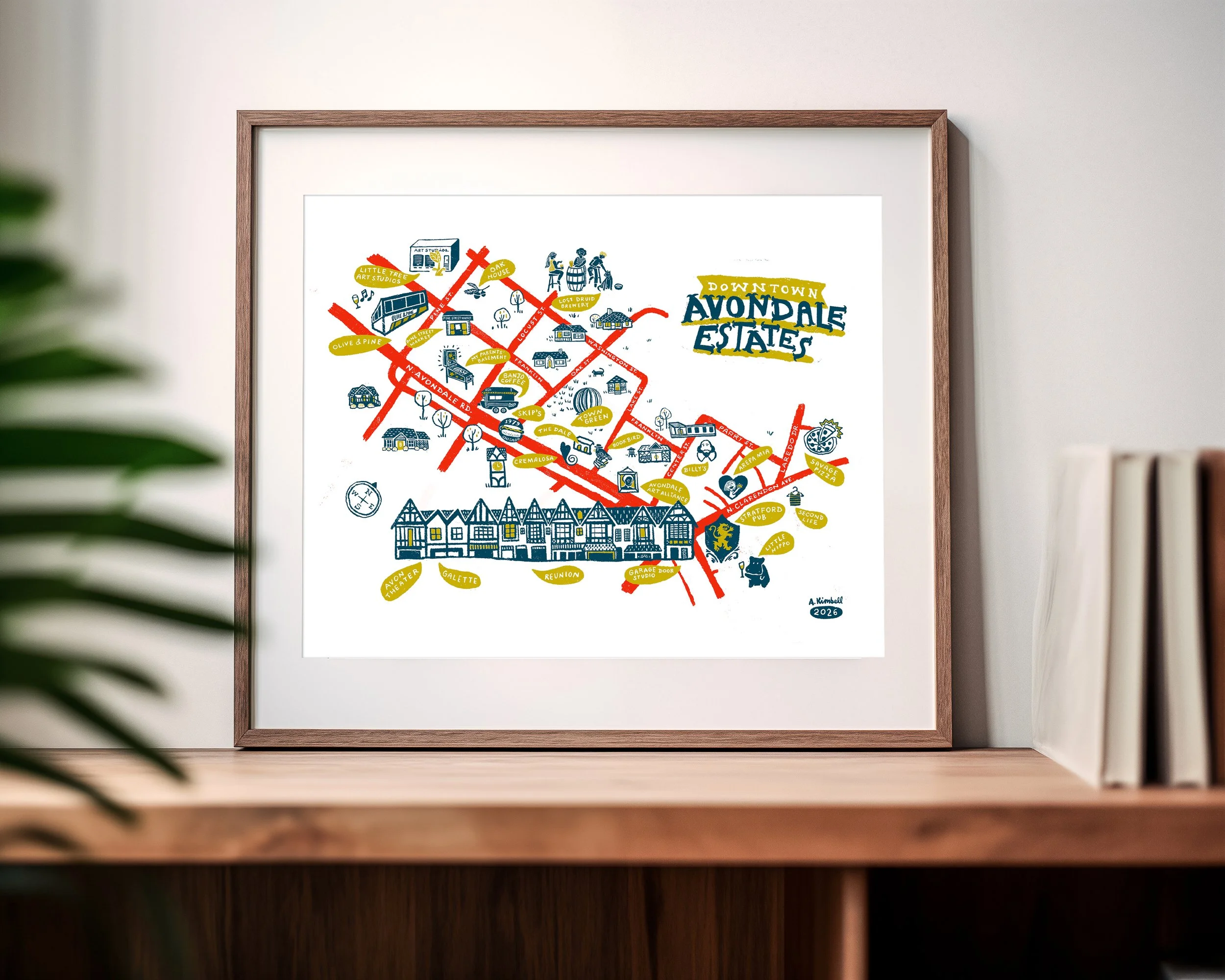 Image 3 of 4
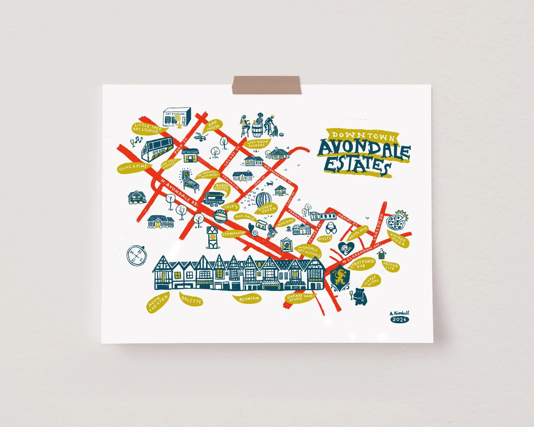 Image 4 of 4
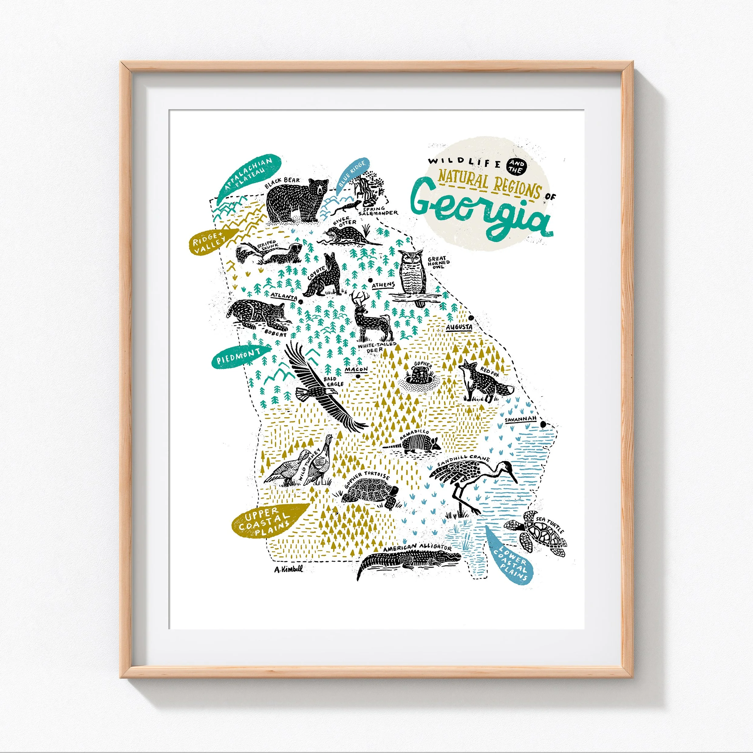
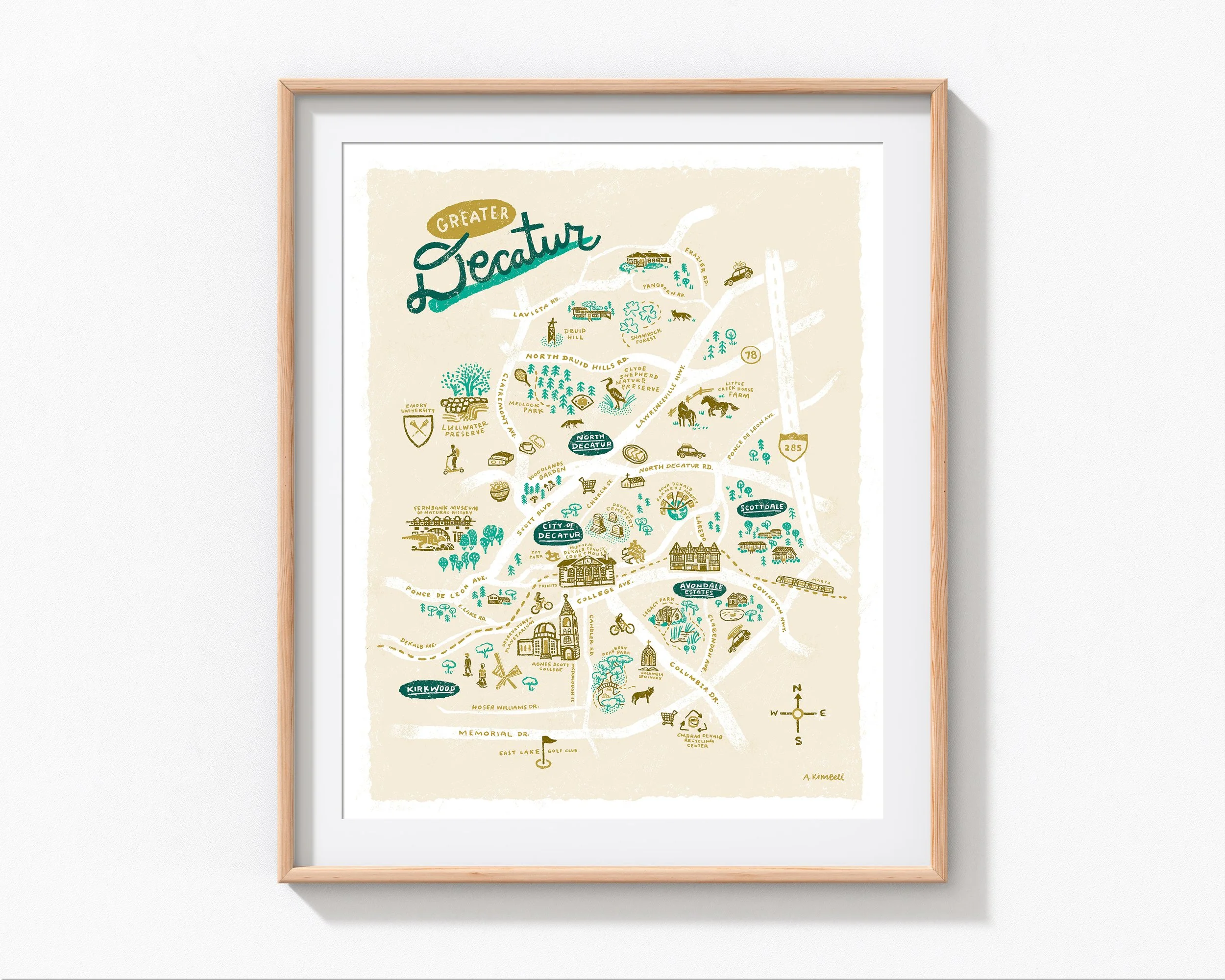
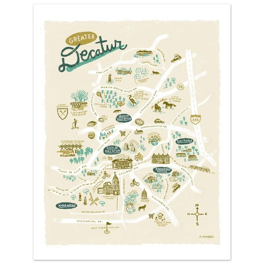
Updated this year to reflect Avondale’s new construction, this is a unique map of the downtown Avondale Estates village, sometimes referred to as the “Rail Arts District.” This map features the iconic Tudor row, plus my favorite retail stores, restaurants, coffee shops, and other historic establishments that make this area such a special part of Atlanta.
Hand-designed, lettered, and illustrated.
Two sizes available: 16"x20" and 8"x10" (unframed)
Printed on white, premium, matte 200 gsm/ 80 lb paper, which has a natural, smooth uncoated finish. It’s both durable and luxurious.
FSC-certified paper or equivalent certifications depending on regional availability
Printed on demand, each poster is rolled and shipped in robust packaging.
Please note: This item is printed by a third party and production happens almost immediately. Therefore we cannot accept cancellations or refunds for this product.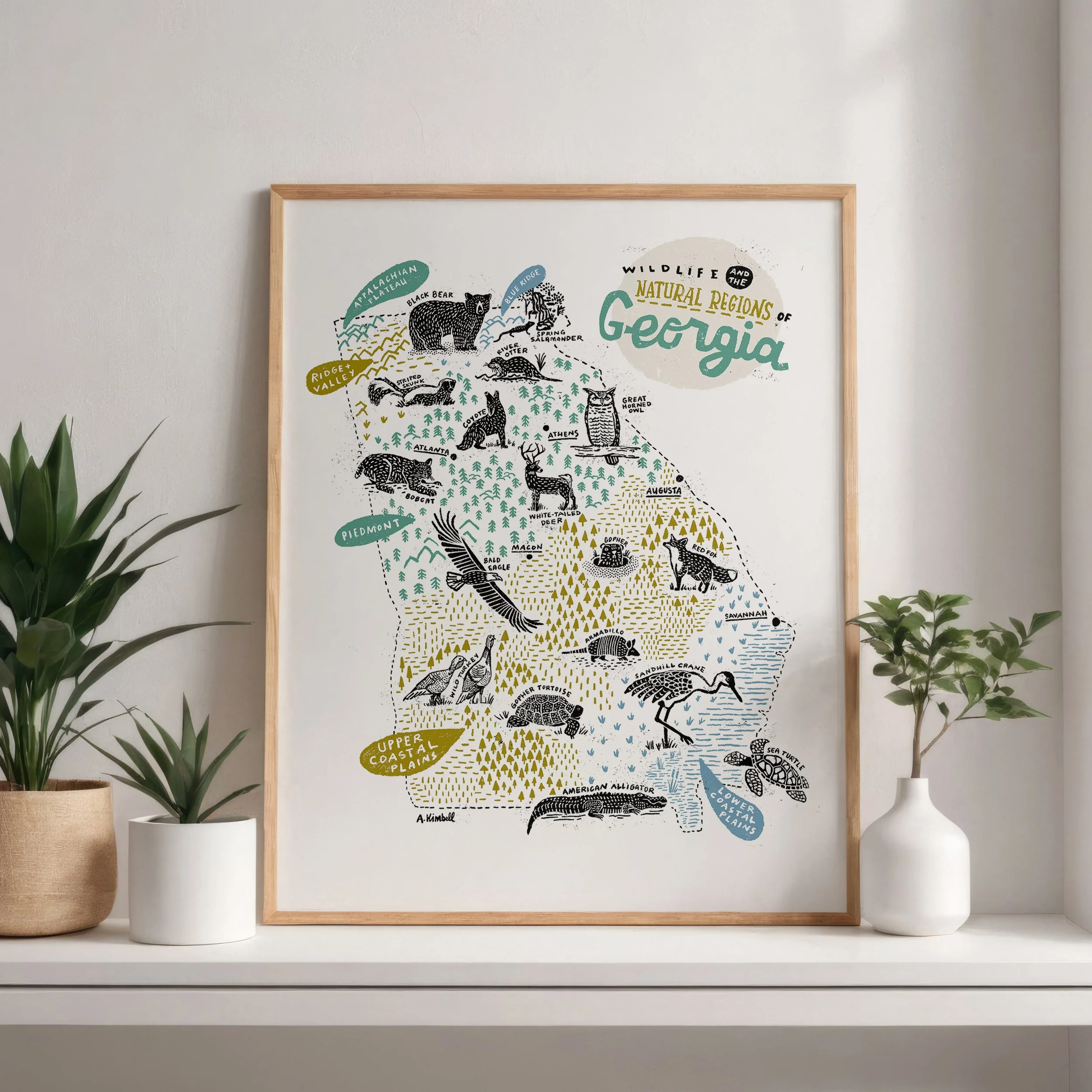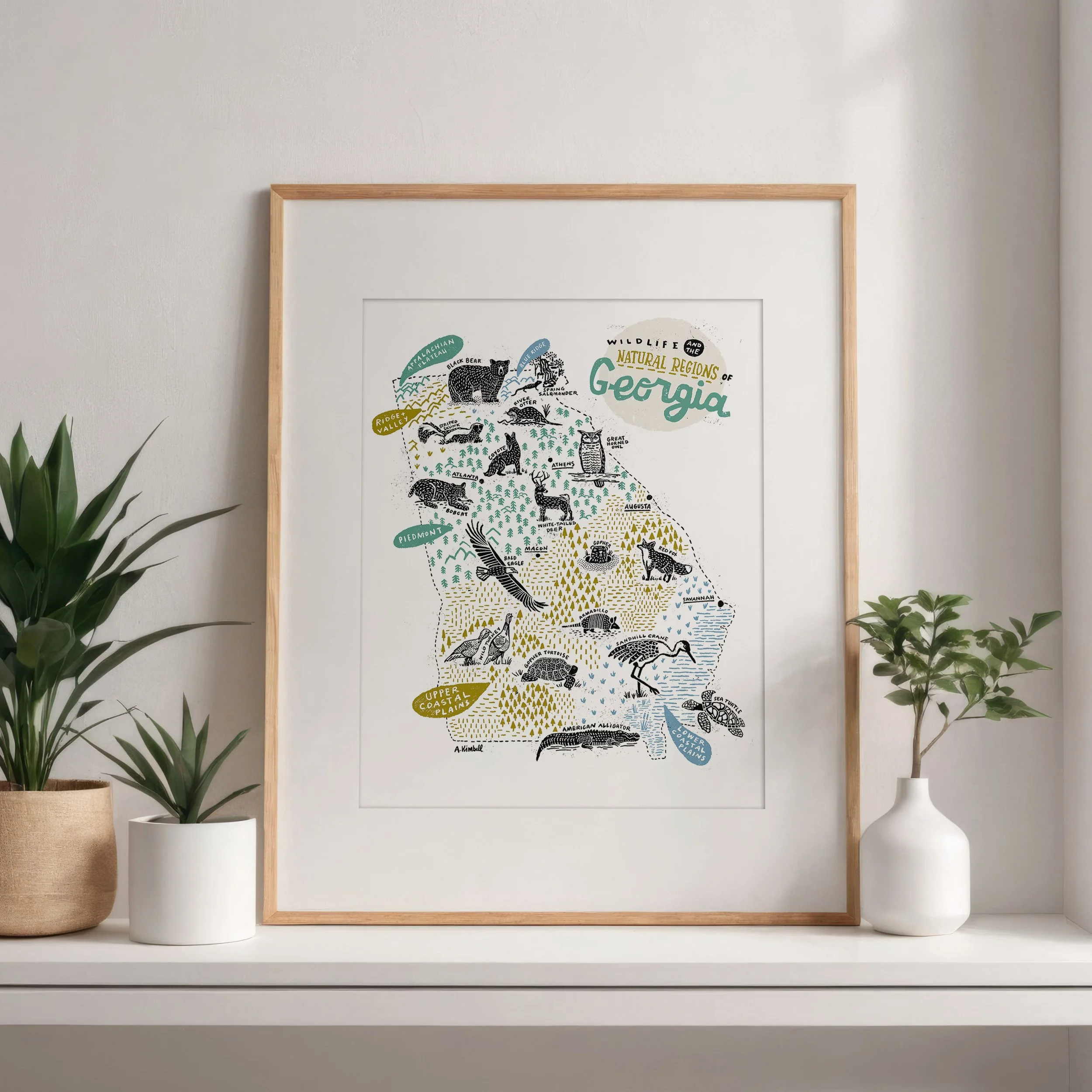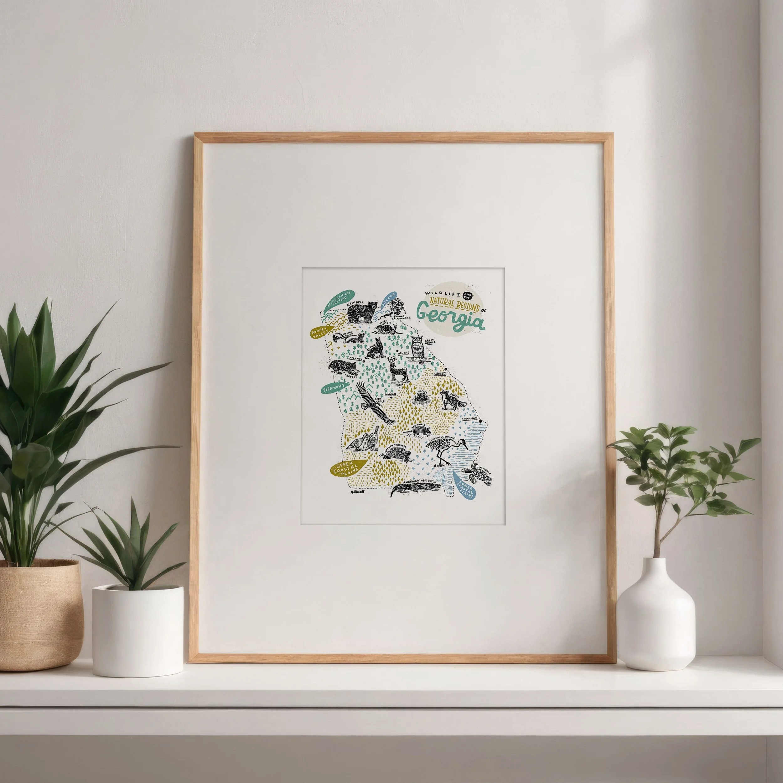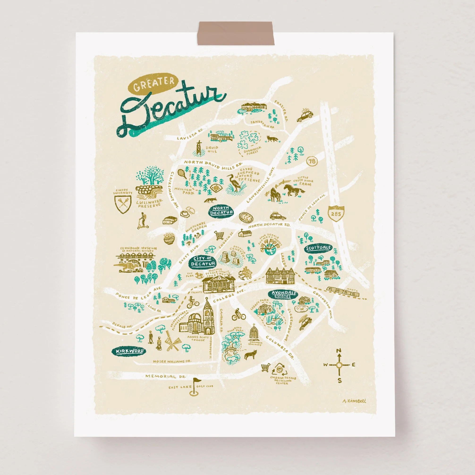